Above Abyss is a “new” Slickrock alternative
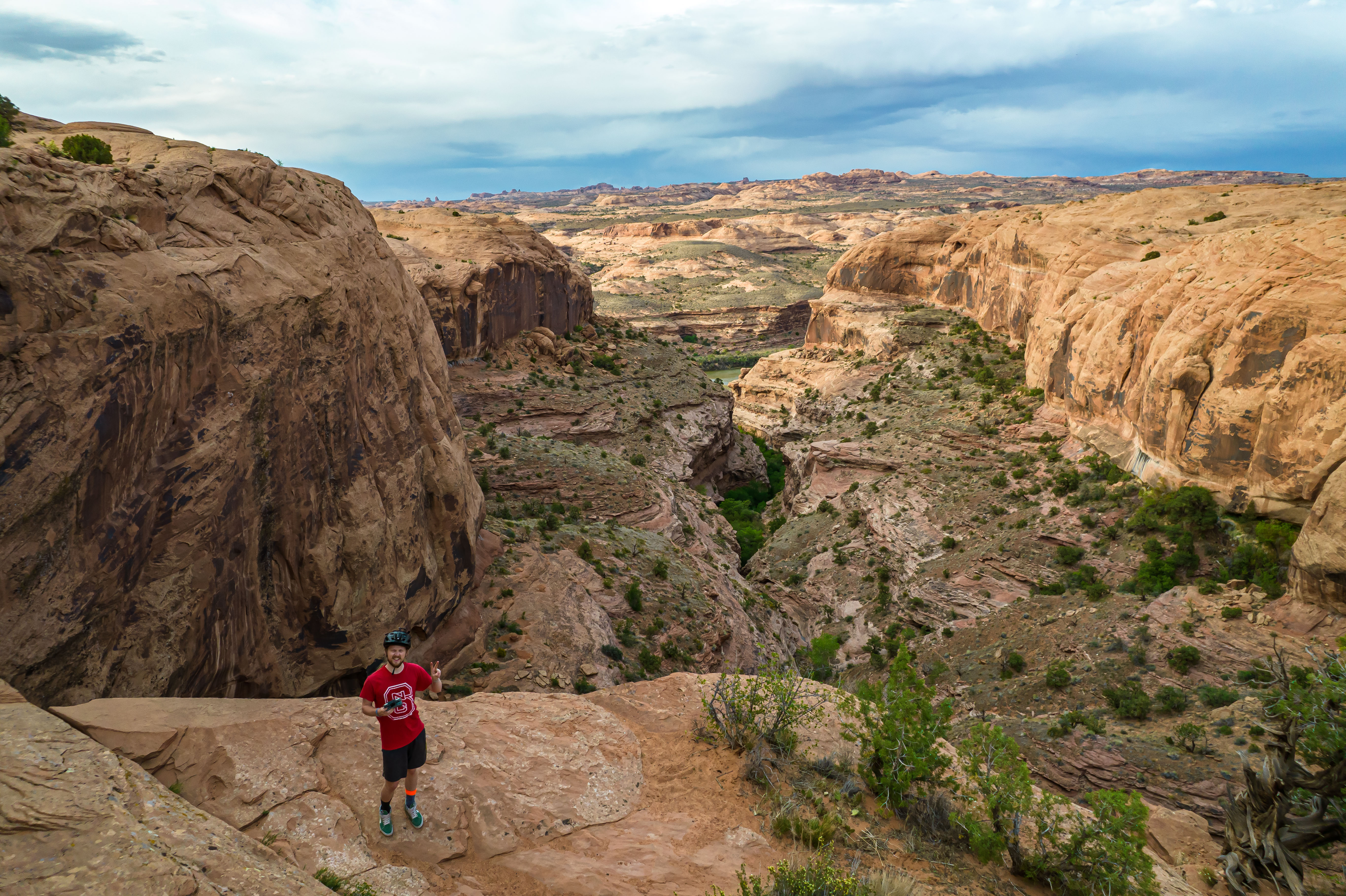
Here’s me, taking a selfie with my drone in front of Icebox Canyon at the overlook on the Above Abyss trail. I don’t think there’s a trail down in the canyon itself, but it certainly looks like a fun hike from above. Photo by Carter Pape, licensed for exclusive use
When I wrote about Slickrock a few months ago, the image the story led with was of me, bent over with my bike, catching my breath. It was an appropriate means of expressing how “grueling” the trail is, as the headline read.
Above Abyss is a shorter alternative route to the full Slickrock trail. Whereas the full Slickrock ride is 8.9 miles, excluding the practice loop, the Above Abyss loop is a couple of miles shorter.
Although the trail is marked as blue square (intermediate) difficulty on Trailforks, I would grade it the same as the rest of Slickrock at black diamond (very difficult). It’s easier than the main ride, but in my opinion, only because it’s shorter.
Above Abyss gets its name presumably from the overlook it passes at the northernmost point of the trail, Icebox Canyon. The canyon is relatively short and narrow, so you can see the river from the overlook on the trail.
The overlook is not, however, short in height. I didn’t measure it out, but I would guess the cliff face overlooking the canyon is at least 200 feet tall. It’s sufficient to be deadly if you fall.
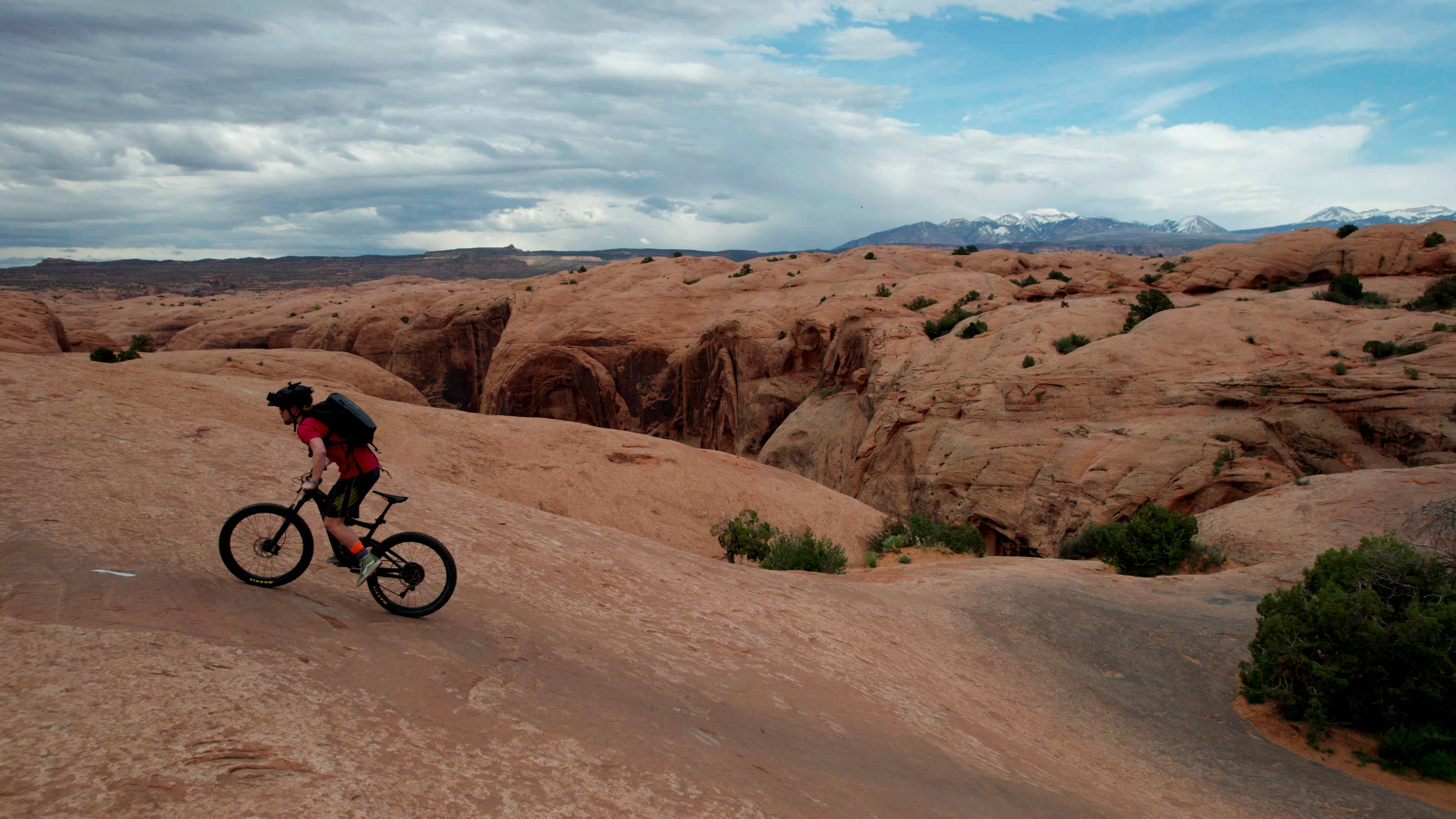
The climbs along the Slickrock and Above Abyss bike trails appear less intimidating in profile than they are during the trek itself. Many of the paths go right against the gradient of the trail — no zig-zagging to make the climb easier. Photo by Carter Pape, licensed for exclusive use
Of course, this height is simultaneously beautiful and intimidating. I brought my drone out on my most recent ride to get a better look of the place, and it was so worth it.
I purchased the drone last month because I have been looking for better ways to photograph and document all the scenes around Moab. It’s one thing to take a great landscape photo from ground level at an overlook; it is a totally different thing to have the mobility of a drone to get better angles and perspectives of the same place.
But before I get too deep into that, more on the Above Abyss trail itself: The terrain is pretty similar to the main Slickrock loop. It’s a lot of smooth Navajo Sandstone with the occasional bumpy spell or sandpit.
It’s also chock full of steep climbs and descents. The main Slickrock trail doesn’t give riders any breaks, and Above Abyss is the same way. When Dick Wilson originally blazed and conquered the trail, he was on a motorized rather than manual bicycle. It’s very apparent from the trail itself.
Above Abyss is not part of that original trail, though. The signs that mark the route since 2019 have read, “Welcome to the new trail Above Abyss,” and I wonder every time I see the signs at what point the trail will stop being “new.”
Above Abyss diverges from the main Slickrock trail about 1.5 miles in. The divergence is very subtle. You have to know what you’re looking for because there are no signs advertising the trail, except once you are well into it.
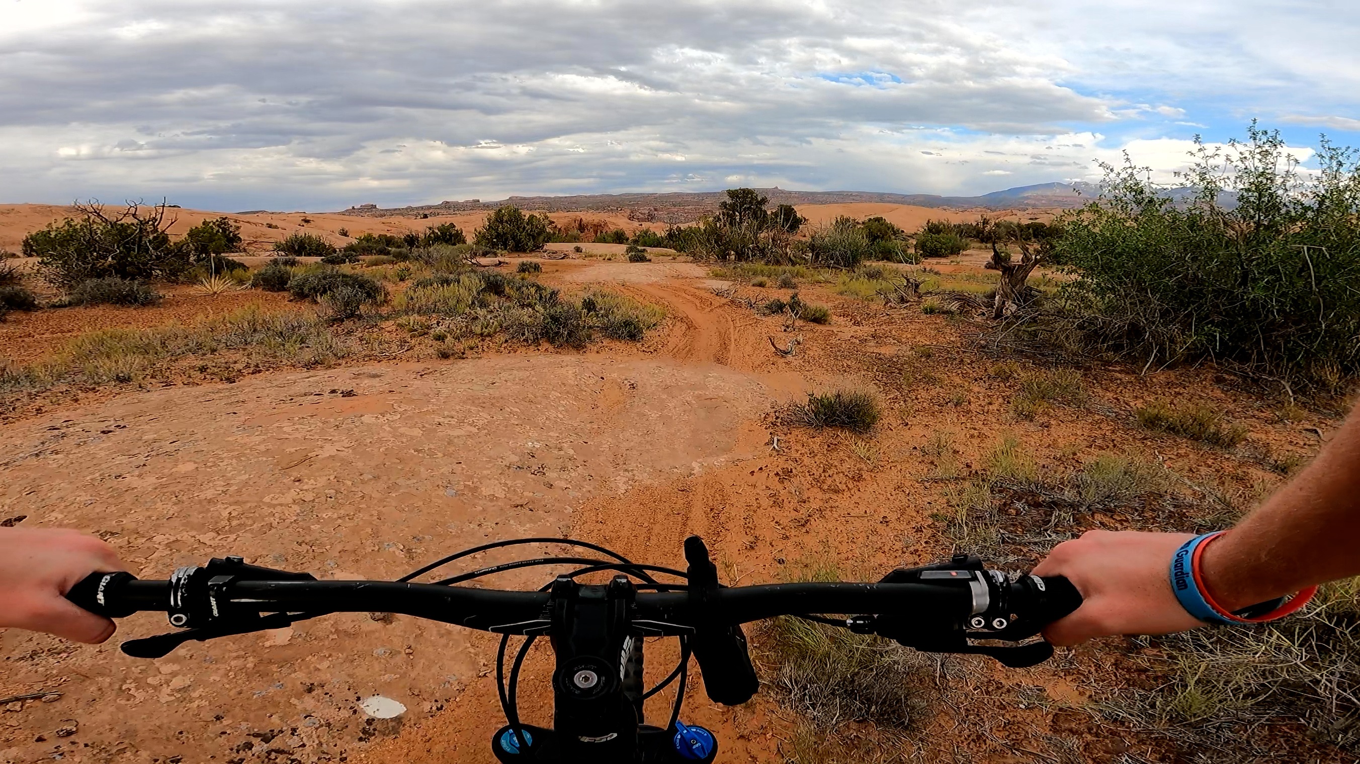
The view from my chest-strapped GoPro during my ride on Above Abyss. At the left is one of the signs that label the trail as “new” even though it has been open at least two years now. Photo by Carter Pape, licensed for exclusive use
Rather than being marked with white lines, the trail is marked with white dots spray painted on the rock. For that reason, it can get hard to follow at times. I still get lost in certain sections I should know better by now.
The overlook above Icebox Canyon is near the tail end of the two-mile offshoot. Again, you kind of have to know what you’re looking for. The trail splits as it comes into a bowl-shaped clearing, and you’ll turn right to follow the path until it says “Stop” on the ground in front of you.
I can’t do the scene justice with words the way my colleague Sophia Fisher can, but I do have a drone and the photos of the place I took with it, so I’ll refer you to those rather than stumbling through a poor attempt at artful language.
What I will say is that I stop at the Icebox Canyon overlook for a full 10 minutes every time I pass it (except when I’m racing the sunset). It’s far enough from Hells Revenge and protected by rock, so the off-highway vehicles are out of earshot. Highway 128 is far enough away that traffic is inaudible. It’s just the wind and the birds.
And my drone. I feel a little bad every time I launch the thing around Moab because it’s not loud per se, but it is enough to stand out in the very quiet places where I take it.
I personally have no ill will toward the sound or sight of drones, but I’m not the only person in the soundscape. There are physical limitations that make silencing aircraft difficult, but I am hold-ing out hope that I can one day get my hands on propellers that can’t scare wildlife or humans in flight.
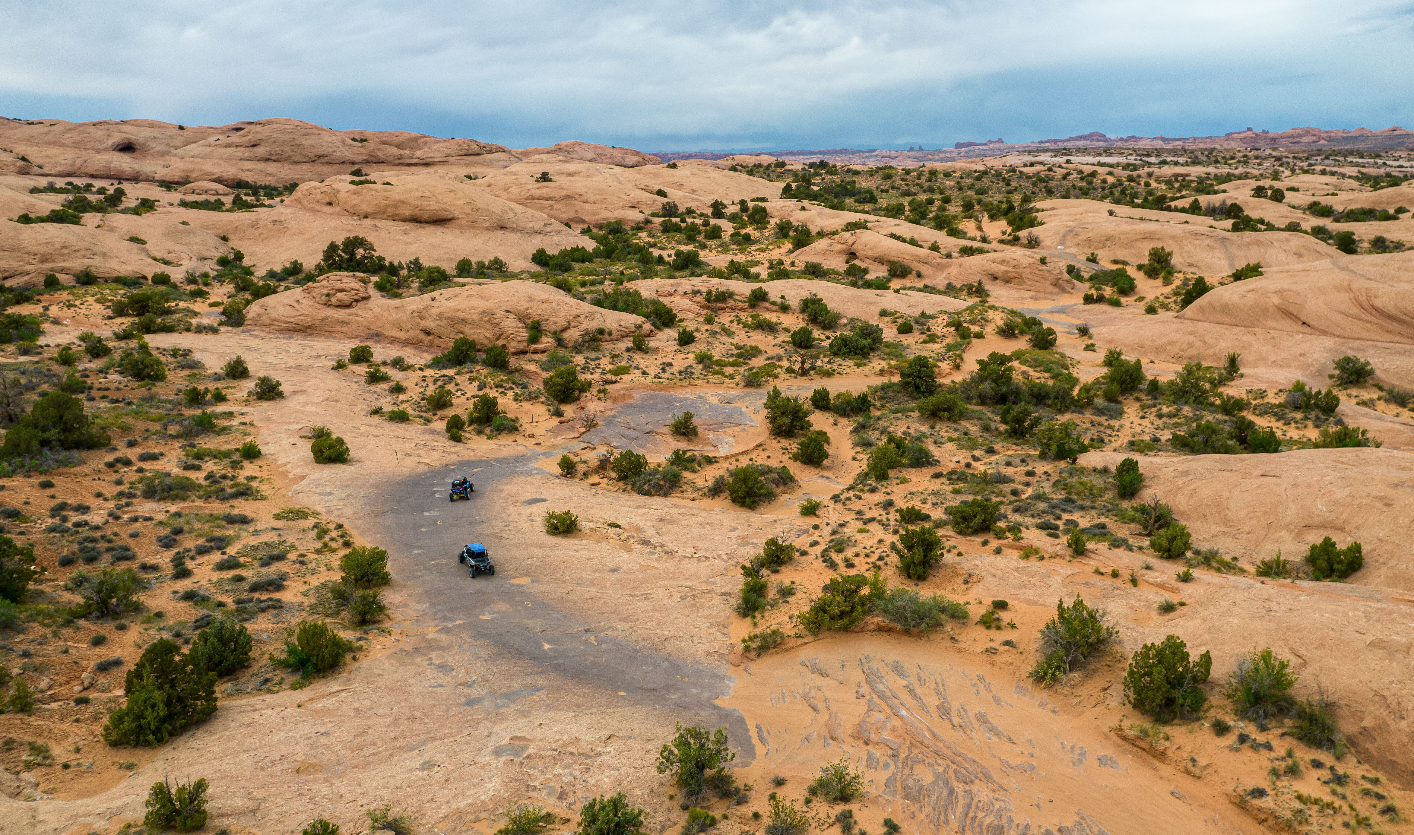
Hell’s Revenge, a renowned 4x4 trail in the Sand Flats Recreation Area, criss-crosses with the Slickrock bike trail, which leads to the Above Abyss offshoot trail. Photo by Carter Pape, licensed for exclusive use