Flat Pass pits bikers against drivers, and it’s fun.
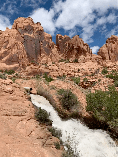
In wetter days, Faux Falls gushes with an awe-inspiring intensity and volume. It really makes me want to cry; I just want to be around this much water again. Carter Pape, licensed CC BY-SA 4.0
When I was first scouting bike routes around Moab to eventually try, I came across Flat Pass as an option that I put low on my list. This weekend, as I decided between competing with likely crowding at Dead Horse Point State Park or escape from crowds at Flat Pass, I couldn’t remember why I had put it low on my list.
I drove out to park my car at the Grand Water and Sewer Service Agency building, biked up to Ken’s Lake, further up to Faux Falls, then down a short decline, and remembered why I had put it low on my list: Flat Pass is a four-wheeler route also known as Steel Bender.
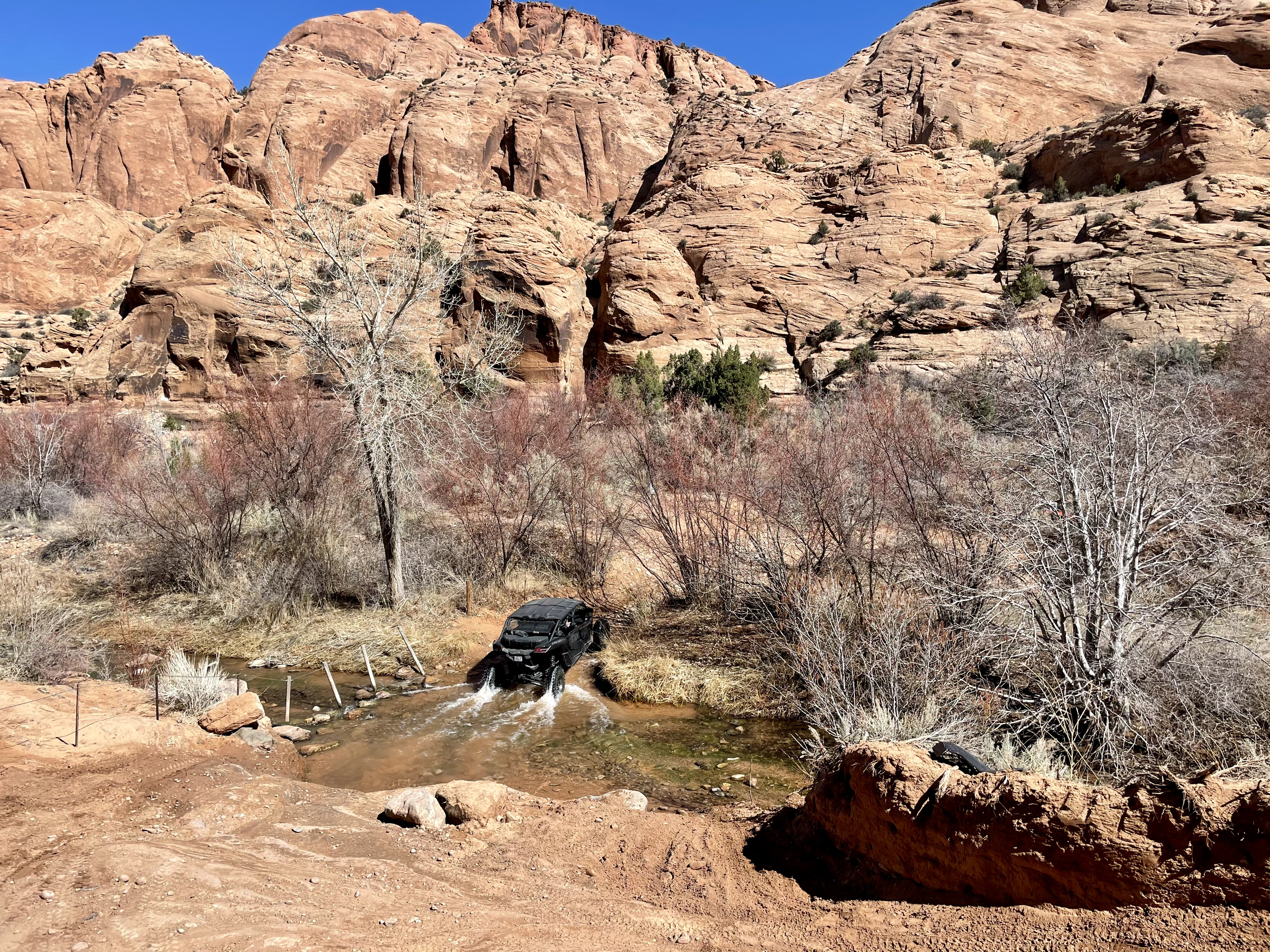
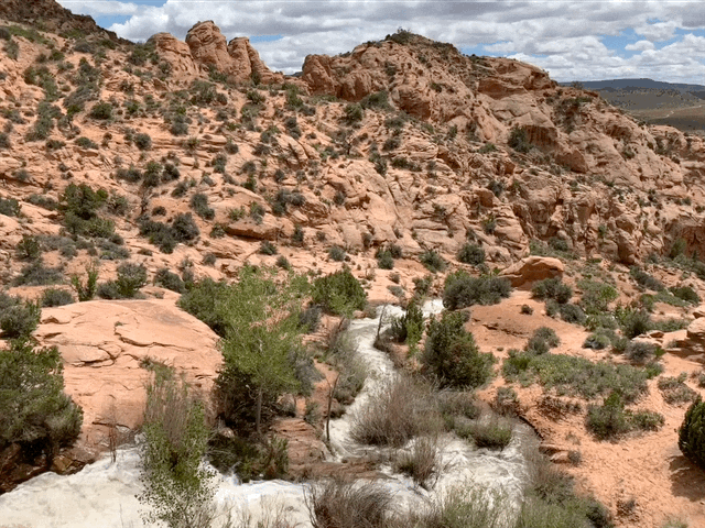
Mill Creek runs over Flat Pass in four places. Riding from Ken’s Lake toward town on the trail, the passes get successively deeper. I finished the ride with my shoes soaked. Carter Pape, licensed for exclusive use
I started preparing to warn readers about the bad time I was about to have. I’ve foregone Poison Spider and other big-name trails around Moab exactly because they are built for Jeeps and off-highway vehicles. Reportedly, they are no fun because they have deep sand and loud vehicles flying down them.
However, after soon pulling over to let a three-vehicle UTV caravan pass, I soon ended up as alone as you can hope to be on a blazed trail in Moab during spring. I saw people, but I didn’t have to stop or pull over for anyone the rest of the ride.
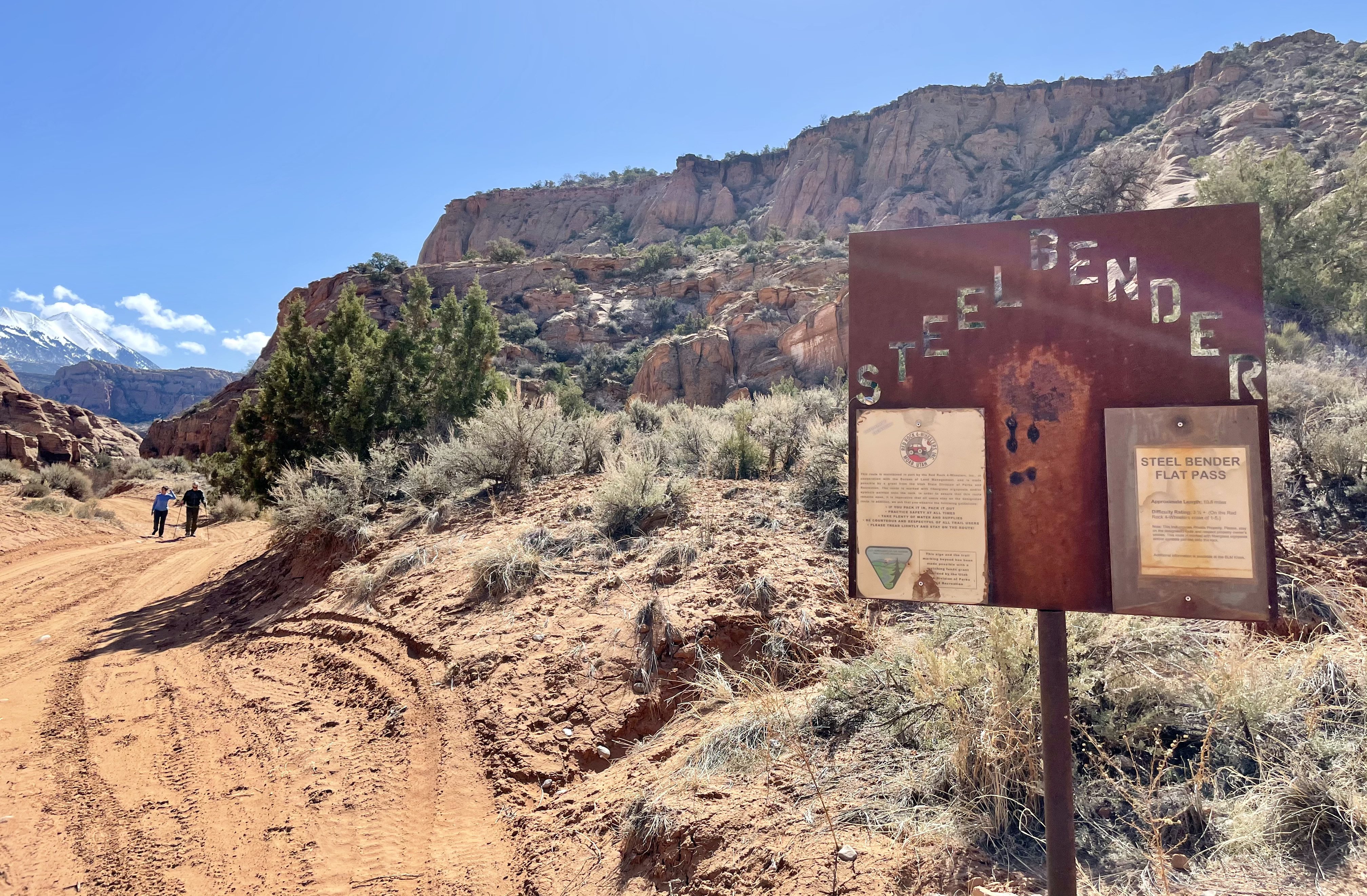
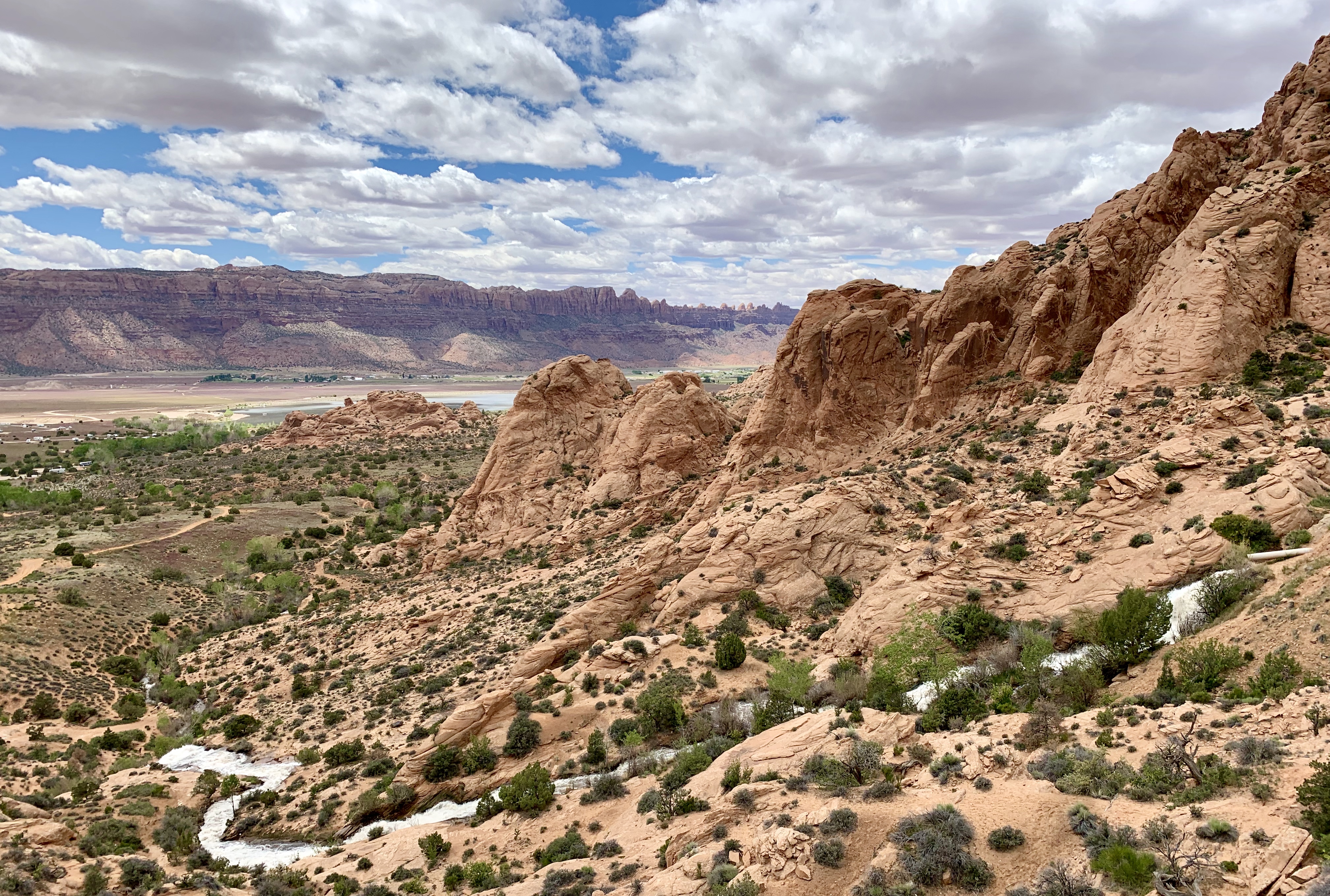
Flat Pass, also known to four-wheel drivers as Steel Bender, is a trail designed with vehicles in mind but perfectly usable for hikers and bikers alike. Carter Pape, licensed for exclusive use
Beyond that, the trail itself was also quite exciting. Its elevation profile is a chevron, which I have said before is the best way to plan a trail. Have riders reach a peak then head downhill the rest of the ride. None of this nonsense of climbing then descending then climbing again then and so on.
Most importantly, the sand is perfectly manageable, for the most part. The last mile or two (as I mentioned, I started at Ken’s Lake and headed northwest) put me into pretty deep sand and a few Mill Creek crossings that got my feet and bike chain wet and sandy. I had to walk my bike through deep sand at a few points at that stage, as well.
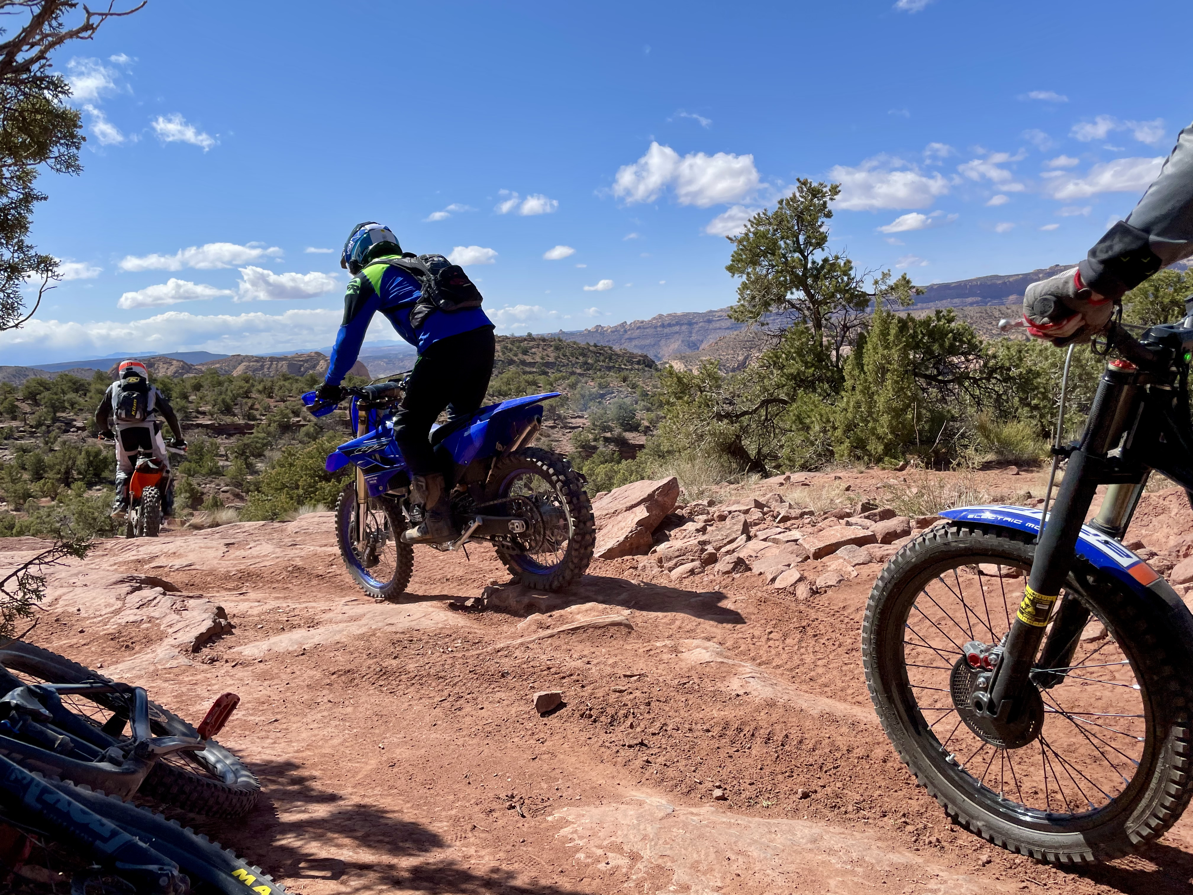
Dirt bikers ride past me as I sit for a breather. Carter Pape, licensed for exclusive use
To that point, the trail was mostly large, solid rock or, in some sections, loose, small rock. In other words: It’s a bumpy trail. There are also some seemingly impossible maneuvers to make for bikers, let alone for four-wheeling vehicles.
It kind of reminded me — and made me yearn for — the run-up to Porcupine Rim. There is a four-wheeling trail that bikers can take from Sand Flats to get onto Porcupine Rim, if they aren’t shuttled to Burro Pass or the Porcupine Singletrack above the main trail.
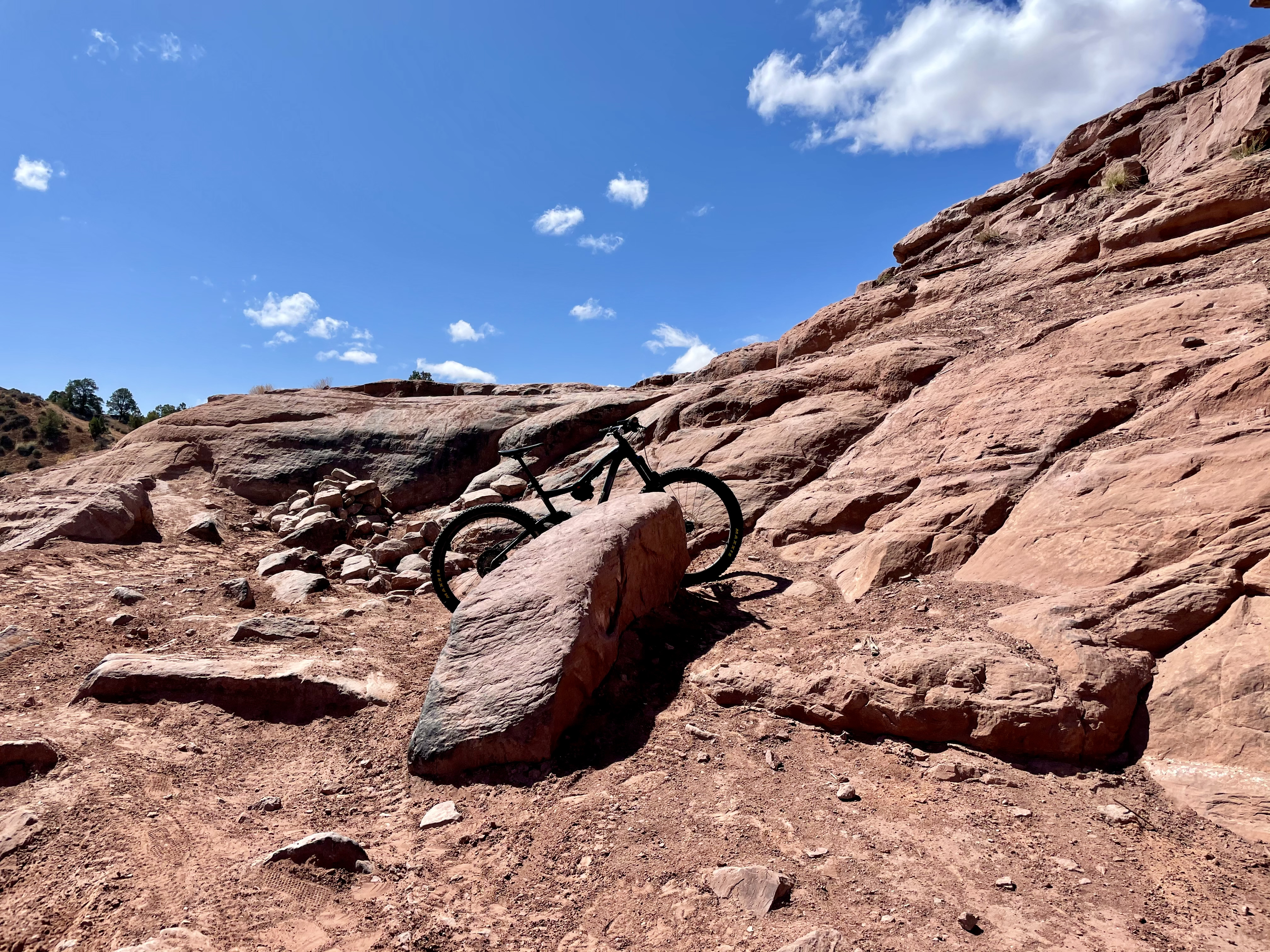
Trails around Moab sometimes include ridiculously difficult obstacles, like this one, though an even taller, equally vertical climb sits just out of view. Carter Pape, licensed for exclusive use
Flat Pass, which as I said is a four-wheeling route, has very similar terrain to the Porcupine Rim four-wheeling trail. It’s also similar to Cliffhanger, which is the four-wheeling route in the Amasa Back and Captain Ahab area. Those are the best comparisons for me.
The trail is rated as a black diamond on MTB Project, which is created by REI. Trailforks, which is a similar app and website, didn’t even document Flat Pass as a trail. I recorded my ride, though, and plan to upload it and add it to the database.
This photo from 2019 shows Ken’s Lake and Faux Falls in better days, with a more robust Mill Creek feeding an artificial cascade that feeds the artificial lake below. Just because it’s faux doesn’t mean it’s ugly. Carter Pape, licensed for exclusive use
The group of drivers who passed me right at the beginning of the trail were friendly and cheered me on when I passed them later on. They never caught up to me, even though I dared them to try.
I also saw a group of dirt bikers, some other UTV drivers, and a group of three Jeep drivers were deflating their tires in preparation for a drive as I finished the trail.
Part of the deal with riding Flat Pass is that bikers either need a shuttle or to ride down Spanish Valley Drive. Parking at Ken’s Lake means back-loading the climb; parking near the end of the trail front-loads it. Carter Pape, licensed for exclusive use
I don’t mind competing with vehicles that have combustion engines, besides when I find myself following too closely and inhaling their fumes. The piercing sound of Polaris RZRs can be annoying, but in the context of being out on my bike rather than on my couch in my apartment, I find it to actually be kind of nice.
In fact, passing by OHVs when I’m out on my bike brings back memories of the one time I got to drive an OHV down the Kane Creek Canyon trail. I splashed mud on my passengers and flew over the sandy bits like they were nothing. It was kind of like the one time I shot a gun; it was fun but failed to alleviate all my concerns.
Perhaps the thing I love about off-highway vehicles is seeing them where they belong and are built to be: off-highway.
Carter Pape, licensed CC BY-SA 4.0