Klonzo, the land of one-way trails

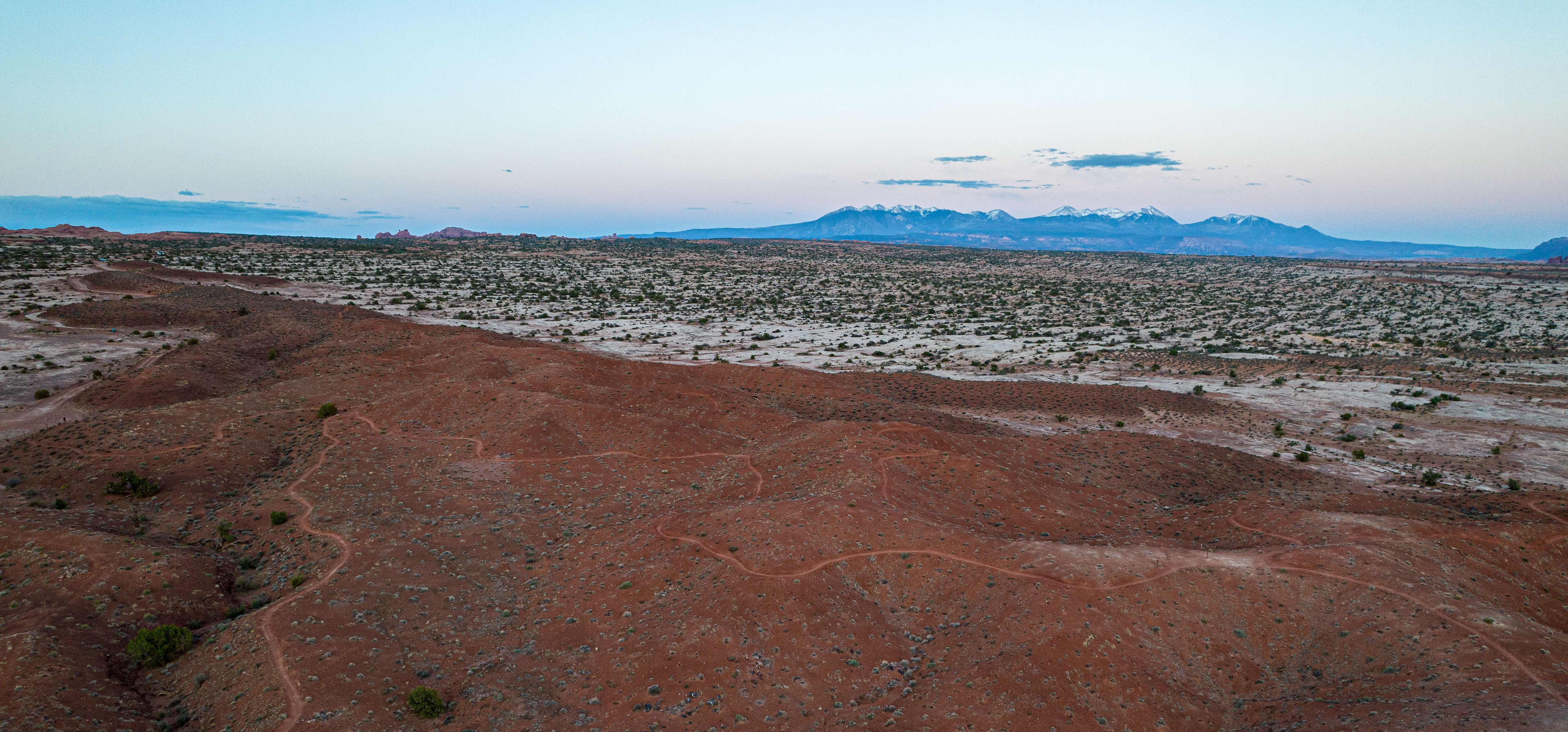
The Klonzo bike network looks small on a map but expands once ridden, as there is a multitude of trail options in both the northern and southern portions. Photo by Carter Pape, licensed for exclusive use
The maps at the southern parking lot for the Klonzo mountain bike trails serve as a reminder of just how many biking opportunities there are in Moab (a lot) and what makes a trail fun.
One of the maps depicts sectioned-off areas north of Moab designated by the Bureau of Land Management as mountain biking areas. Most of the land is not designated as mountain biking areas, but the number and extent of the trail networks is striking to see on the map.
The depicted area extends east tp Arches National Park, west to Dead Horse Point State Park, south to the river and north to Interstate 70. It includes squiggles for all the various bike trails maintained by the Bureau in the area.
Most of Klonzo is relatively mild. The two trails that the Bureau of Land Management has marked as black diamonds are Gravitron and Vertigo, both in the northern section. Photo by Carter Pape, licensed for exclusive use
Somebody added the map to the board recently because I don’t have a good photo of it. I try to always make sure I have photos of these boards of maps when I make a trip to a trail. What if I get lost or otherwise want to look back at the map later?
The other telling map is of the Klonzo area itself. Specifically, the one-way designations. Should you ever find a trail that is designated as one-way, ride it (the correct direction, of course).
There are many reasons that one-way trails are so fun. One is that you can count on not running into anybody on your way down it (unless you’re passing someone slower). If you’re the type to send it through blind corners, you can feel slightly safer doing so knowing that you shouldn’t run into anyone climbing uphill.

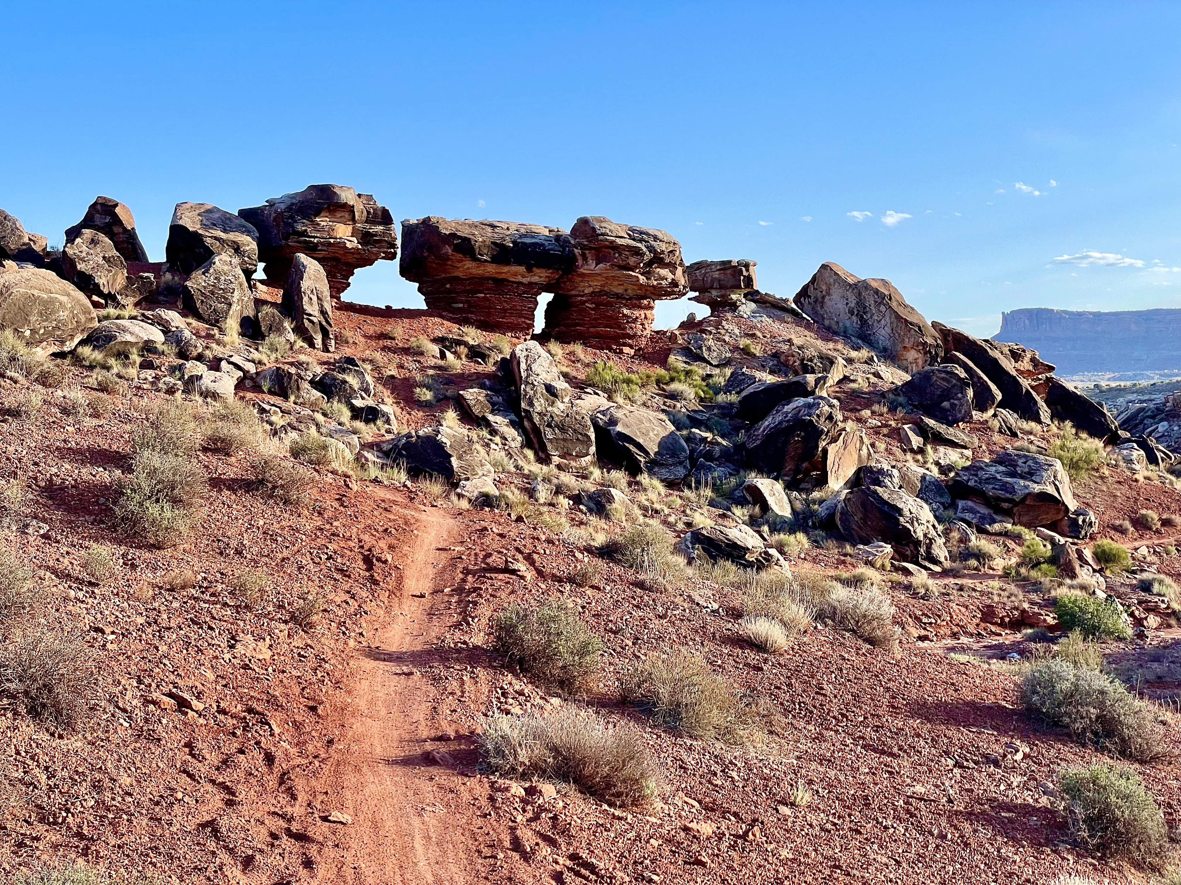
These three rocks sitting atop thinning sandstone pillars reminded me of the UFO in the Klondike trail network, north of Klonzo. Photo by Carter Pape, licensed for exclusive use
Another benefit of one-way trails is flow. The term is hard to describe, but I might call it the physical equivalent of the mental flow that sometimes happens when you are doing work that you enjoy or are good at.
One sign of flow is that you’re going downhill. I’m sure you could find a biker who would tell you that they hit a flow state while climbing, but that is actually called sadism. (Just kidding; I’m happy for anyone who enjoys climbing.)
Another sign of flow is that you’re going the recommended direction on a trail. There’s a reason the trailmaker wants you going clockwise, for example, rather than counterclockwise. As a sign in Dead Horse Point State Park puts it, some paths are “more fun.”

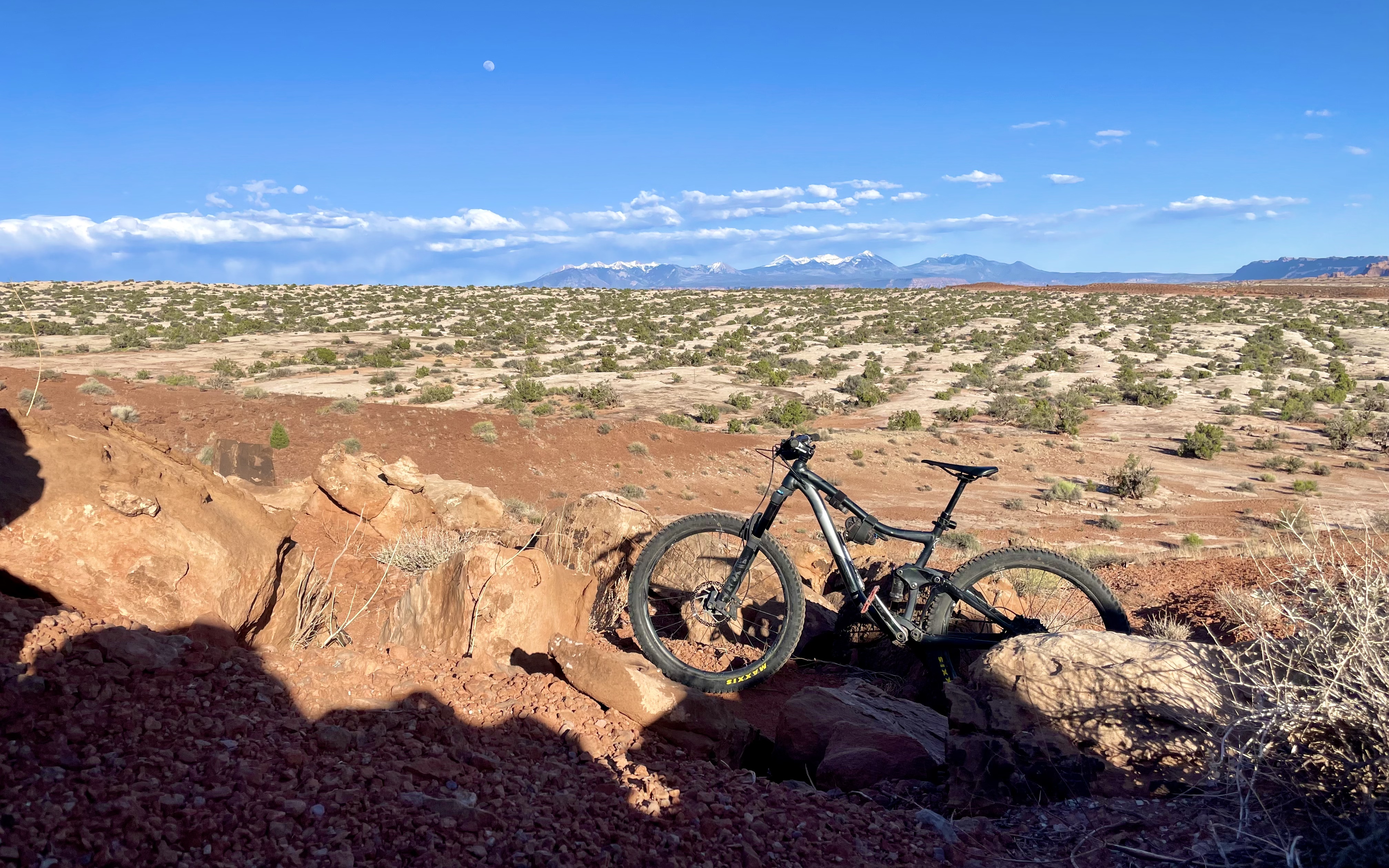
Can you spot the photographer in this photo? (I can’t, but maybe you can.) Photo by Carter Pape, licensed for exclusive use
At Klonzo, there are a few one-way trails, and they each promote the flow state. One is Gravitron, the black diamond trail at the northern end of the system. Another is Redhot, which is an aptly-named part of the south section.
As I learned firsthand this weekend, you have to keep both hands on the handlebars while riding Gravitron. The name is a bit on the nose; the trail gets riders sideways on banked turns, tilted forward on downhills and drops, and into their seats in bowls.
Gravitron is not the most extreme example of going off-vertical to stay on your bike. There are faster and more extreme trails around Moab. It’s worth a ride regardless.
In the southern section of Klonzo, Houdini is a bumpy ride similar to Circle O in the Moab Brands. They both ride over the same, white stone that has not enjoyed the same windblown smoothing as the sandstone on the Slickrock bike trail. Photo by Carter Pape, licensed for exclusive use
Redhot is a blue square trail in the southern section of Klonzo. It contrasts starkly with another trail that feeds into it: Houdini. The two are vastly different in terms of experience despite being directly connected.
While Houdini is flat, bumpy and slow, Redhot is downhill, smooth and fast. I don’t know exactly how Redhot got its name, but you can hit pretty high speeds on the little jaunt, and it runs over classically red Moab soil. The name is a bit on the nose, but it’s fun.
Redhot also parallels a trail named Hotdog. I mention it only because I want to make sure you know that Moab has trail by the name of Hotdog.
Many — I would estimate most — bike rides in Moab include reminders that cows are roaming nearby, but they’re too afraid of grates to try stepping over them. Cows are silly. Photo by Carter Pape, licensed for exclusive use
Klonzo is small in footprint, but when you string the trails it contains together, it’s long enough for a full day of riding. Trailforks puts the network at 24 miles in total distance.
Just down the Willow Springs Road from Klonzo is the Sovereign trail system. I have not yet ridden those trails, but I am told that it has some of the hardest trails Moab has to offer.
That’s kind of funny to me, given their proximity to Klonzo, which seems to be at the easier end for Moab trails. I guess I’ll have to try Sovereign next.